SH73 ARTHUR’S PASS VILLAGE TO KUMARA JUNCTION – FLOODING – 7:35AM
Due to surface flooding and slips, road users are advised to take extra care when travelling along this route. ^JP pic.twitter.com/hs69qvqzGU— NZ Transport Agency – Canterbury & West Coast (@nztacwc) October 9, 2025
“For the west coast from Waikato down to Taranaki, it’s going to stay fairly cloudy during the day, with a few spots of drizzle.”
Mercer said the North Island’s east coast would experience the finest weather of the day.
“Temperatures are going to be on the relatively warm side,” he said.
“We’re looking at temperatures up to 27C for Napier and Hastings. It’s also going to be very warm overnight with temperatures up to 15C.”
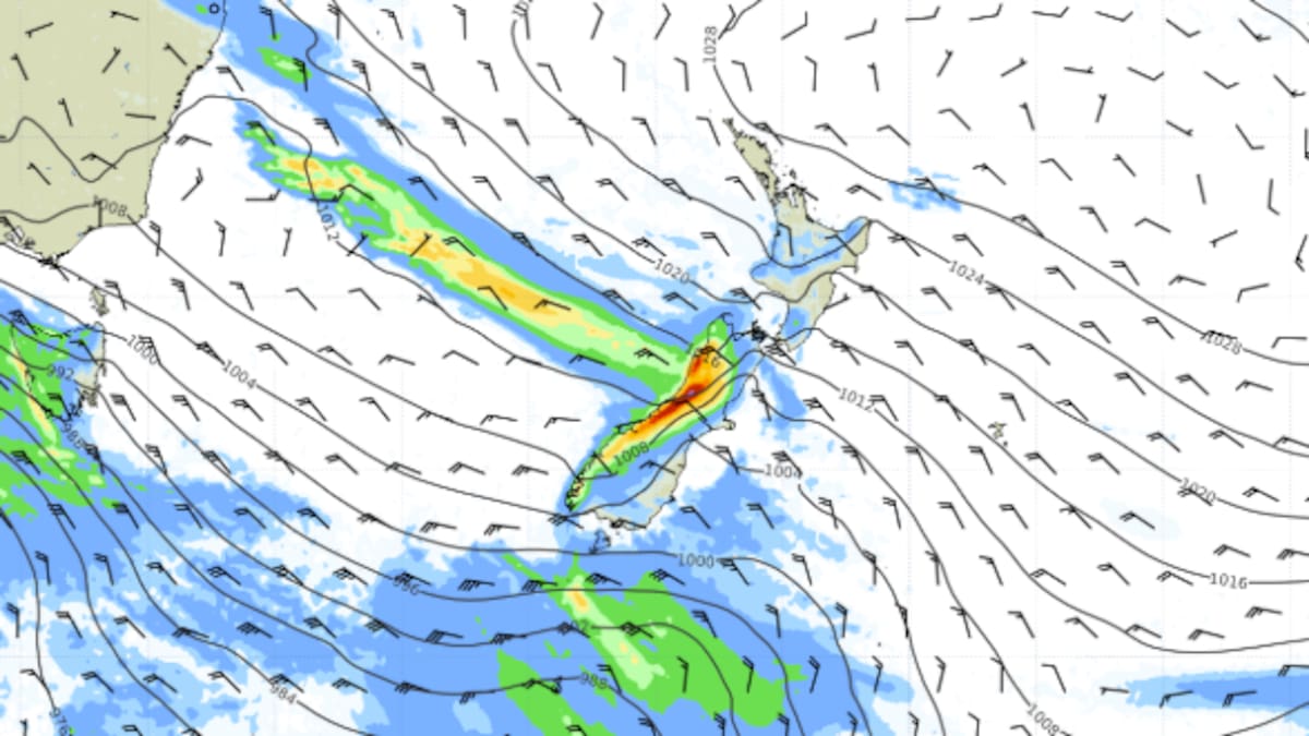
In the South Island, rain is expected from Buller to Fiordland.
🟡Updated Watches and Warnings🟠
Buller and Grey have been upgraded to Orange Heavy Rain Warnings🌧️ It’s looking like a wet few days through there
Canterbury High Country has also been upped to an Orange Warning for Wind💨
Head to https://t.co/qHyE5zzql5 for full details pic.twitter.com/dYNfGFZ7wI
— MetService (@MetService) October 9, 2025
“There are going to be heavy falls around Buller and Westland, and the Grey District,” Mercer said.
“During the morning, the rain will ease to showers from Fiordland to Buller.”
Heavy rain warnings are in place for the Westland District, headwaters of the Canterbury lakes and rivers, and the Grey District until late morning, where between 120mm and 160mm is forecast to fall.
A heavy rain watch is in place for the Buller District until 1pm tomorrow.
“Expect 250 to 350 mm of rain, especially about the ranges. Peak rates of 15 to 25 mm/h expected Friday and Saturday mornings.”
A strong wind watch is also in place for the Canterbury hgh country until 7am, with severe gale northwesterlies gusting 120 km/h in exposed places forecast.
Weekend weather
Cloudy conditions with occasional showers are forecast for the North Island tomorrow.
“It should be pretty dry for the East Coast down from Gisborne down to Wairarapa,” Mercer said.
“[There will be] scattered rain in the other parts.”
Mercer said rain would become widespread throughout the North Island on Sunday.
“There will possibly be some heavy falls later in the day, particularly about the ranges.”
Rain and showers are forecast to continue on the West Coast of the South Island on Saturday.
“Possible heavy falls particularly about the Buller area, but there is that risk of heavy falls on the whole West Coast,” Mercer said.
“About the east coast and including Central Otago, it’s going to be quite fine on Saturday.”
Sign up to The Daily H, a free newsletter curated by our editors and delivered straight to your inbox every weekday.


