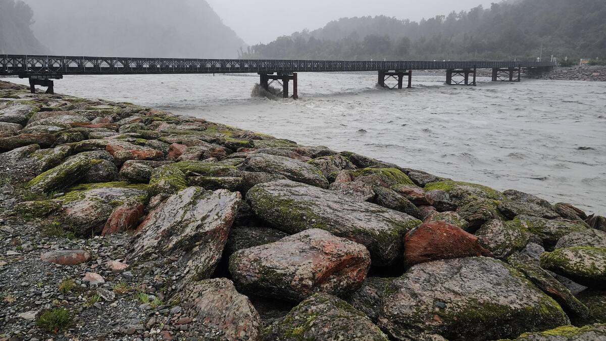
Lash told the Herald locals have been rallying around one another while self-evacuees seek refuge and damages are assessed.
“They’re a resilient bunch and they just get on and do it, they help emergency services where they can and they put themselves where they need to be,” she said.
She said in Franz Josef, the weather is improving significantly.
“We’re currently in Franz Josef and we’re looking at blue skies so things are looking up,” she said.
Lash said residents were already out and about making the most of the easing rain.
“There’s people already out kayaking on the lake so we’re getting on with it and we look forward to getting things back to normal,” she said.
Lash advises motorists in the area to stay up to date, and remember that driving in some areas is still hazardous.
“As far as slips go there’s still that risk, night-time the time not to be on the road there’s still that volatile ground so just be wary of that,” she said.
She said with the easing rain, work will soon be underway to assess damage to roads and properties in the area.
“The roading crews will be out inspecting as soon as it’s safe to do so, these teams are onto it and they get out there pretty instantaneously so we’ll be getting things sorted fairly quickly out here,” she said.
In the latest update, West Coast Emergency Management announced State Highway 6 between Ross and Fox Glacier is now open but there is still some surface flooding around.
“Between Fox Glacier and Haast, State Highway 6 remains closed throughout the weekend due to slips, flooding and cracks in the road near Knights Point.
“Waka Kotahi will provide an update on this situation on Monday morning. All other highways are currently open and travellers are advised to head North,” it said.
They also said while some people remain marooned, there is accommodation available in most towns.

MetService meteorologist Chelsea Glue said rain was easing across northern Buller, north of Hokitika and the warnings for most of Westland have now expired.
“Grey and Buller Districts are still in an orange warning but that’s expected to lift in the next few hours,” she said.
She said from a rainfall perspective, things are trending in the right direction but reminded residents to be wary on the roads, particularly around rivers.
“River levels still can rise, there can be a delay between the rainfall and the rivers rising so please do be mindful of that when you’re out and about,” she said.
Niwa described the overnight and morning rainfall in Fiordland and the West Coast as “exceptional, even by the standards of this very wet region”, in its own post to X, adding that Franz Josef was having its wettest day (9am-9am) since 1979.
For Lake Moeraki it was its wettest day on records that go back to 1985, Niwa wrote.
As of 5pm, NZ Transport Agency said in a post on X that SH6 between Ross and Fox Glacier is now open.

SH6 between Haast Pass and Makarora had been closed earlier, but is now open.
“There is a lot of water around our Westland communities and travelling is hazardous with surface flooding and potential slips. If you don’t need to travel, please stay home,” West Coast Emergency Management wrote on Facebook.
Twenty-four-hour rain totals at key rainfall sites included:
- 492mm at Haast River Gauge at Roaring Billy (Niwa), 25.5mm (last hour)
- 476mm at Waiho River (Douglas Hutt) (Niwa), 30.5mm (last hour)
- 413.5mm at Waiho River (state highway bridge), 9.6mm (last hour)
- 386.5mm at Cropp River (Niwa), 27mm (last hour)
These totals were slightly higher than originally forecast but in line with the latest MetService warning issued last night, the council wrote.
In a 1pm update, Westland District Council reported river levels are starting to drop as rain eases in South Westland.

River levels are as follows:
Waiho: 7.7m and dropping
Haast: 5m and dropping
Arawhata: 5.1m and dropping
Hokitika River (the gorge): 4.4m and steady
Hokitika River (Kaniere Bridge): 5.65m and rising
They said hourly rainfall totals in the Hokitika catchment remain high, causing rivers to continue to rise within the catchment, particularly in the gorge and Kaniere bridge.
This includes 24-hour totals of:
451mm Cropp River (Niwa) and 26.5mm (last hour)
373mm Hokitika River at Colliers Creek and 8.5mm (last hour)
West Coast Emergency Management said in their most recent update the water level at Kaniere Bridge is expected to peak between around 6pm today as water comes through from the Hokitika Gorge.
“This coincides with high tide, so West Coast Regional Council hydrology staff and engineers on site monitoring situation.”
The river is expected to peak at 6m, which is causing flooding around the Kaniere Kokatahi area.
Council teams are managing river alerts as they flow through the system, and teams are observing flow and water levels as they rise, the council wrote.
“We ask that anyone who has been isolated and is in need of support, or whose home has been affected by the event get in touch by calling the CDEM Duty number, 03 769 9323,” said Controller Kevin Hague.

The rain is subsiding, but some rivers will continue to rise as the rainfall moves from the ranges to the river mouths, he said.
“If you can, stay put and avoid driving. Some of the local roads are still closed, which is preventing people travelling easily, but we expect this to lessen over the next few hours.
“If you need to travel and encounter a road that is closed, please respect the signage and don’t drive through flood waters.”
Katie Oliver is a Christchurch-based Multimedia Journalist and breaking news reporter.


